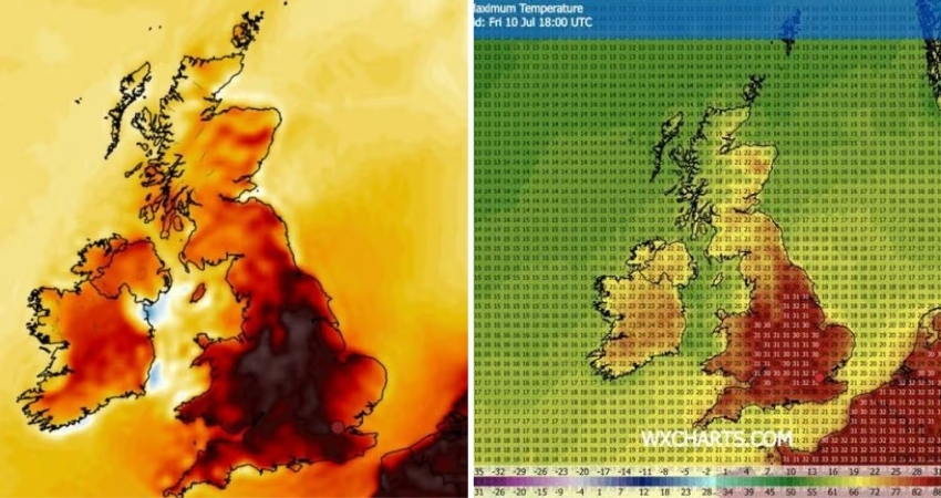
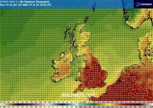
Weather maps have turned a deep volcanic red as they point to the next spell of heat, with parts of the UK expected to climb back above 30C. Some areas of England could see highs of around 31C in Hull, 30C in Manchester, and 31C in Birmingham and Bristol by around 6pm on July 10.
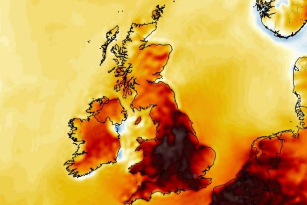
That comes from a WX Charts forecast issued on Saturday, June 27. The same data suggests highs in the upper 20Cs along parts of the south coast, 24–27C in Wales, around 21–22C in Northern Ireland, and 16–24C in Scotland. Temperatures are shown rising from July 9, before peaking at 31–33C around July 11, with London possibly hitting 33C. However, long-range forecasts at this distance should be treated with caution.
The Met Office does not publish detailed forecasts this far ahead. Its latest outlook currently only covers up to July 5, showing temperatures of around 23C in Plymouth, 22C in Cardiff, 27C in London, 19C in Belfast, and 18C in Aberdeen.
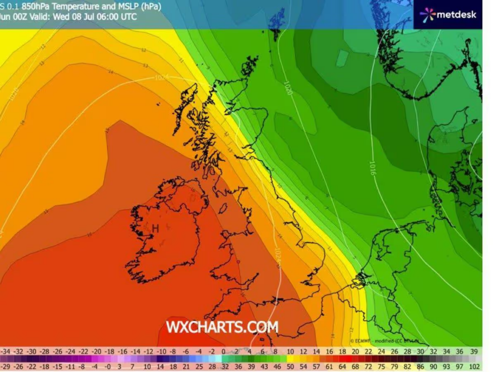
Looking further ahead, the Met Office long-range forecast suggests high pressure is “slightly more likely” between July 11 and 25, which would increase the chances of more settled, drier-than-average conditions.
The warmer outlook follows a recent intense heatwave that pushed temperatures to record levels. Friday was confirmed as the UK’s hottest June day on record, with 37.3C recorded in Santon Downham, Suffolk. That beat Thursday’s 36.7C seen in Merryfield, Somerset.
The new peak has broken a June temperature record that stood since 1976 by more than 1C, a significant margin for such extremes. Scientists say events like this would have been extremely unlikely 50 years ago, with climate change making heatwaves more frequent and intense.
An amber extreme heat warning remains in place across parts of southeast England and East Anglia until 9pm on Saturday.
Met Office chief forecaster Andy Page said conditions are expected to gradually ease, though the southeast will hold onto the warmth longest, with low 30s still possible under the warning area.
Next week is expected to bring a more mixed picture, with a blend of sunshine and cloud, occasional rain moving in from the west, and generally cooler conditions compared with recent days.
The Met Office five-day outlook from Saturday, June 27 to Wednesday, July 1 is titled “turning less hot over the weekend”. It forecasts showers in places, some possibly thundery in the east and southeast, with rain edging into Northern Ireland and western Scotland later.
While some regions stay warm and muggy, especially in the southeast, temperatures are expected to ease overall. Sunday starts cloudy for many before turning brighter, while Monday through Wednesday should feel fresher with sunny spells, light winds, and only a few scattered showers.